
June 2020 was Singapore’s wettest June in a decade. This has put the spotlight back on the need to tackle climate change as the island-state continues to experience increasingly unusual weather phenomena.
To continue reading, subscribe to Eco‑Business.
There's something for everyone. We offer a range of subscription plans.
- Access our stories and receive our Insights Weekly newsletter with the free EB Member plan.
- Unlock unlimited access to our content and archive with EB Circle.
- Publish your content with EB Premium.
Recently, it was announced that Singapore plans to tap into carbon capture, use and storage (CCUS) technology to reduce its impact on the climate from some of its most carbon-intensive industries. This technology captures carbon dioxide from the source of emissions before they escape into the atmosphere, safely stores it, and eventually repurposes it to produce value-added chemicals and other mineralisation products for landfills and the construction industry.
Such industry collaborations are no doubt promising, but with the world prioritising a Covid-19 recovery in recent months, more needs to be done to meet climate goals.
A glimpse into a smarter future
The last few months have provided a glimpse into what a cleaner future could look like. The global lockdown meant that daily greenhouse gas emissions plunged 17 per cent by early April compared with 2019 levels, according to analysis from Nature Climate Change.
In Asia, the decline was obvious: Malaysia reported a 30 per cent decline, Indonesia saw an 18 per cent drop, while Thailand and Philippines saw a 21 per cent and 19 per cent decline in carbon dioxide levels, respectively. Yet, as Asia gradually enters its Covid-19 recovery phase and eases out of lockdown measures, pollution levels are likely to rise once again.
Given most of the decline and subsequent rebound in carbon emissions has come from road transport, we must be vigilant in our efforts to encourage the public to change their lifestyles. We must also improve air standards and reduce our carbon footprint by utilising the full range of technology at our disposal. Only then can we effect more permanent change.
Reducing emissions with data
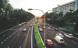
The priority for global cities in the next few years will be to cut air pollution levels and emissions. This was already a major concern prior to lockdown, with nine in ten people breathing dirty air, and pollution resulting in seven million deaths every year, according to the World Health Organisation. As traffic volumes boom once again, the role of smart technology in tackling pollution will be crucial.
Enabling people to move through cities safely and sustainably demands a more nuanced approach. A highly connected smart city infrastructure represents a major opportunity for achieving this change. Extensively embedded Internet of Things (IoT) sensors can gather a wider variety of data. IoT refers to a system of connected devices and sensors that can communicate with one another without human-to-human or human-to-machine interaction.
From real-time traffic information and detailed vehicle emissions to temperature and wind direction, fusing data from various sources can reveal valuable insights. These can be used to make informed decisions designed to reduce air pollution levels and achieve net-zero emissions.
For example, IoT sensors embedded within smart streetlamps can produce data on traffic congestion, which may result in commuters or even delivery drivers avoiding certain roads at times when they are known to be a problem. This would prevent traffic congestion and cut emissions and air pollution—a key area the Singapore government is targeting.
Earlier this year, Singapore also announced its targets for 2040 with a plan to phase out internal combustion engine vehicles, paving the way for greater adoption of hybrids and electric vehicles (EV) that run on cleaner energy.
However, one main challenge would be to build a robust national charging infrastructure, which is where data can help. By highlighting unique usage patterns in specific areas, such as busier or quieter shopping malls across the island, city planners have a clearer picture of citizen behaviour in a particular location. This can remove a lot of the guesswork from infrastructure-related decision making.
Data can also be used to develop new pricing models for road tax and congestion charges. In the next couple of years, Singapore will develop electronic road pricing tariffs that vary depending on occupancy, time of day, duration of the journey, distance travelled, and vehicle and fuel type. Sensor infrastructure and data analytics will be at the heart of this new commercial model.
Predict to protect
If the current situation has taught us anything, it is that we need to make decisions that will benefit us, not just for the here and now, but for the unforeseeable future. Forecasting trends based on the data available to us can help us to interpret behaviours and strategise to alleviate air pollution levels accordingly. This can make it possible to manage any future increases in air pollution effectively.
Cities globally must invest in data and understand activity and trends in different industries. Only then can they make informed, real-time decisions and ensure emissions reduction goals are achieved.
One industry that could benefit greatly from geospatial data is the maritime sector. Shipping is one of the world’s most polluting industries and Singapore is the busiest port in the world in terms of shipping tonnage, with more than 130,000 vessel calls annually.
If left unchecked, maritime pollution could produce 17 per cent of all emissions by 2050. By combining location, fuel and emissions data from ships, companies, ports and governments, it becomes possible to deliver real-time visibility into operations and decide what works and plan accordingly.
Bringing geospatial data to life can provide valuable perspectives for governments to meet the needs of the population returning to normality. The sooner we can create a platform able to ingest vast amounts of data, the sooner policymakers can act decisively to improve the quality of people’s lives and environment. This kind of data-driven decision making, along with real-time monitoring and management of physical world systems, is critical when it comes to improving real-world outcomes.
As we navigate a path back to normality, we cannot go backwards environmentally. We must use this situation as motivation to utilise all the data at our disposal to ramp up environmental standards. We can have a better, cleaner and more data-driven future for ourselves and the planet.
Richard Baker is the chief executive officer at Cambridge-headquartered big data analytics company GeoSpock.


