One of the last and largest remnants of tropical rainforest in Asia is under threat from multiple road development plans.
This forest complex, a UNESCO World Heritage Site known as the Tropical Rainforest Heritage of Sumatra (TRHS), is located on the spine of the Bukit Barisan Mountain Range in Indonesia’s main western island, Sumatra.
Occupying 2.5 million hectares (9,652 square miles), the site comprises three national parks: Mount Leuser, Kerinci Seblat and Bukit Barisan Selatan National Parks.
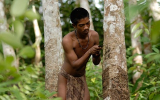
Due to its size and location, the site is hailed as one of the largest conservation areas in Southeast Asia and the last habitat for many endangered animals. It is home to an estimated 10,000 plant species and more than 200 mammal species, including the Critically Endangered Sumatran orangutan, tiger, rhinoceros and elephant.
There are currently plans to develop roads in all three national parks, with a particular focus on Kerinci Seblat. The officials backing these projects cite increased economic opportunities for local people, as well as the need for evacuation routes in case of natural disasters.
“
Even before the construction of the road was finished, encroachment already ate up forests on both sides of the road. There’s no road built in the Leuser ecosystem that isn’t followed by encroachment.
Rudi Putra, Goldman Environmental Prize awardee
Kerinci Seblat National Park
At 1.4 million hectares, Kerinci Seblat is larger than the U.S. state of Connecticut and roughly twice the size of Indonesia’s Bali island. It is the second largest terrestrial protected area in Indonesia, stretching for 350 kilometers (217 miles) from northwest to southeast along the Bukit Barisan Mountains.
According to a 2014 paper by geographer Keith Bettinger, decentralisation reforms that began in the late 1990s led to an increase in proposals to build roads in the districts around Kerinci Seblat.
“[T]he districts, now relatively independent from the central government, increasingly began to question the contribution of the park to district coffers and local livelihoods,” Bettinger wrote.
A recent strategic environmental assessment report (pdf) coordinated by UNESCO shows that there are currently 12 road corridor plans in the park. These proposals call for a combined total of more than 1,360 kilometers of road development — either the construction of completely new roads or the expansion and paving of existing dirt roads.
The 12 road corridor plans are divided into four zones. These proposed roads are said to be for economic purposes, to connect isolated areas or to provide evacuation routes.
In the first zone, in the northeast of the park, plans call for an existing 2-meter wide dirt road to be developed into a 6.5-meter wide paved road stretching 60 kilometers.
Three separate road expansion projects are planned for Zone 2, which lies to the east of Zone 1. Each will convert an existing dirt road into a four-meter-wide paved road, creating over 90-kilometers of newly surfaced routes.
Proposals for Zone 3, in the middle of the park, call for three existing dirt roads ranging from 28.9 to 60 kilometers to be paved and widened. Also planned are two completely new paved roads, 153 kilometers and 744.3 kilometers long and four meters wide.
The fourth zone, in the southern part of the park, has three planned projects. One new road is to be built while two existing roads will be developed into seven-meter-wide paved roads.
Bukit Barisan Selatan National Park
Located at the southwestern tip of Sumatra, Bukit Barisan Selatan National Park stretches over 324,000 hectares (1,250 square miles).
The UNESCO report highlights two road improvement plans there, both located in Lampung district.
“The improvement plans are meant to build paved roads with four to eight meters in width and eight to 11.5 kilometers in length. The functions of the roads are to improve connectivity and economic activities. These routes have obtained permits from the Ministry of Forestry in 1987 and 1993,” the report explained.
In addition, a completely new road is proposed to link the Sumberejo subdistrict of Lampung with the villages of Way Heni and Way Haru on the west coast of Lampung.
“Accessibility and economy are the main reasons to build this road. Another function given to justify this road is to patrol the national park. The road will have width of four to eight meters and length of 10 kilometers. Legally, the proposal has been approved by the Ministry of Forestry in 2010,” said the report.
Mount Leuser National Park
Hundreds of kilometers of roads are planned for Aceh Province’s Mount Leuser National Park and the broader Leuser Ecosystem it is part of. The area is famed as the last place on Earth where tigers, orangutans, elephants and rhinoceros still coexist in the wild.
However, many local officials see more and faster roads as a way to connect isolated villages and bring economic growth to the province, which was hard-hit by both the 2004 Tsunami and decades of conflict.
Dating back to 2002, a 400-kilometer road network called the Ladia Galaska has been cited as one of the most damaging projects worldwide by William Laurance, a research professor at Australia’s James Cook University.
The current Aceh land-use plan contains an expansion of the Ladia Galaska plan, slated to slice through highly sensitive areas of the Leuser Ecosystem and connect the east and west coasts of Aceh.
Acehnese conservationist Rudi Putra, who was awarded Goldman Environmental Prize in 2014 for his work in protecting the Leuser ecosystem, said that the Ladia Galaska project is still going strong, with at least 70 per cent of the project already completed.
“It’s been ongoing since 2002. In the past, it was temporarily halted due to the escalating conflict in Aceh. But after the peace deal was signed [in 2005], the project proceeded,” he told Mongabay.
“Now the name of the project is no longer Ladia Galaska because they [the government] have divided the project into small segments and every year the local governments allocate big budgets for the project.”
With hundreds of kilometers of paved road having been built, encroachment and habitat loss are inevitable.
“Last year, a road to reach a village called Lesten [in Gayo Lues district] was built with a budget of 15 billion rupiah [$1.1 million]. Even before the construction of the road was finished, encroachment already ate up forests on both sides of the road,” Rudi said. “There’s no road built in the Leuser ecosystem that isn’t followed by encroachment.”
The new governor of Aceh, Irwandi Yusuf, who was sworn in the office in July, vowed during his campaign to protect the Leuser Ecosystem, saying he would revoke a proposal to drill for geothermal energy in the park.
“From his statement, it was clear that he would cancel the geothermal project. But I haven’t heard a single statement from him on whether he would cancel the road development projects or not. Hopefully, he’d think of it,” Rudi said.
This story was published with permission from Mongabay.com. Read the full story.


