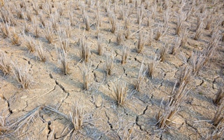
El Niño, the mysterious meteorological phenomenon that periodically upsets global weather patterns, bringing catastrophic flooding to the arid lands of North and South America, and forest fires to South-east Asia, turns out to be more complicated than anyone had thought.
Sandra Banholzer and Simon Donner, environmental scientists at the University of British Columbia in Vancouver, Canada, report in Geophysical Research Letters that some El Niño events don’t turn up the planetary thermostat, and may even contribute to the apparent and much-debated slowdown in the rates of increase in global warming.
An El Niño – Spanish for “The Child”, and given that name by Peruvian fishermen because they observed it around Christmas – is a blister or bubble of ocean surface heat that migrates from the western Pacific to the east, halting or even reversing the prevailing Pacific trade winds, with disconcerting consequences on both sides of the Pacific and Indian Oceans.
The blister analogy is physical, rather than metaphorical. As ocean temperatures rise, so does the volume, and the sea levels can be 45cms higher than the surrounding, cooler ocean.
“
“A pattern of sea surface heights and temperatures has formed that reminds me of the way the Pacific looked in the spring of 1997…That turned out to be the precursor of a big El Niño
Bill Patzert, Jet Propulsion Laboratory at Pasadena, US
Hottest years
But recent studies, say the new report’s two authors, have shown that there may be “different flavours” or types of El Niño. The traditional or eastern equatorial Pacific type is the one that everybody knows about (it made 1998 one of the hottest years ever recorded, and triggered tempests, floods, ice storms, droughts, harvest failures and bushfires around the world). But if an El Niño only gets as far as the central Pacific, it’s a different story, and the effects are more local.
The finding also lends a little extra authority to the forecasts that Australia, which had its hottest ever temperatures in 2013, will see more and worse extremes of heat.
The two authors looked at three sets of data to match long-term changes in global temperatures to the pattern of “hot” and “cold” El Niño events. “Historical analysis,” they say, in the deadpan language of a scientific paper, “indicated that slowdowns in the rate of global warming since the late 1800s may be related to decadal variability in the frequency of different types of El Niño events.”
Meanwhile, Nasa scientists have warned that another traditional El Niño may be on the way. They think so because of data gathered by a satellite called Jason-2, which monitors changes in sea surface height (because pressure, temperature and volume are related, sea surface height becomes another way of taking the ocean’s surface temperature).
“A pattern of sea surface heights and temperatures has formed that reminds me of the way the Pacific looked in the spring of 1997,” says Bill Patzert, of the Jet Propulsion Laboratory at Pasadena, US. “That turned out to be the precursor of a big El Niño.”
Tentative warning
The warning is tentative because it is based only on ripples of change in sea level travelling across the Pacific from Australia to South America. These are linked to changes in the trade winds, and tend to happen from time to time during the southern hemisphere winter. They normally last only a few days, but if they last for months, then an El Niño develops.
For the moment, there is no certainty that one will develop, and nor is there yet any indication of the knock-on effects on global weather patterns.
But although the phenomenon has nothing to do with global warming – it happens anyway, and climatologists have traced evidence of El Niño events back for more than 2000 years – global warming may have something to do with it.
In January, Australian scientists warned that rising levels of greenhouse gases in the atmosphere could increase the frequency of the most severe El Niño events.


