Environmental group Greenpeace on Tuesday launched a new mapping tool which it says offers the most comprehensive look at company concession maps, peatland boundaries and species habitats in Indonesia yet.
To continue reading, subscribe to Eco‑Business.
There's something for everyone. We offer a range of subscription plans.
- Access our stories and receive our Insights Weekly newsletter with the free EB Member plan.
- Unlock unlimited access to our content and archive with EB Circle.
- Publish your content with EB Premium.
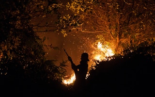
Hundreds of fire hotspots have flared up in the archipelago nation in recent weeks, and the online tool - called Kepo Hutan, which loosely translates to Curious about Forests - lets the public track whether the fires are on palm oil, logging, wood fibre or coal mining concessions, and identify the companies who own the land.
Users can also check if the land in question is forest or peatland, or home to endangered tigers and orangutans, said Greenpeace.
Peatland is a carbon-rich, water-logged soil found in many parts of Indonesia. It must be drained to make it suitable for plantation developments, but is extremely flammable when dry.
Teguh Surya, forest campaigner, Greenpeace Indonesia, said that Indonesia is still recovering from last year’s forest fires disaster which was driven in large part by reckless peatland draining and forest clearing for plantations.
“Greenpeace is making this map data available today … to allow the public to prevent another crisis by monitoring fires in forests and peatlands.”
Identifying the company on whose land the fires are occurring is an important first step to holding companies accountable, as last year’s haze crisis has shown.
Not only did the Indonesian government arrest several people linked to colleagues responsible for the burning, but Singapore-based non-profit Singapore Environment Council also led a consumer boycott against Indonesian firm Asia Pulp and Paper, which was found to have many hotspots on its concessions.
An unprecedented number of fires broke out in Indonesia last year, and the resulting smoke pollution caused almost 20 deaths and more than half a million people had respiratory illnesses linked to the haze. It also grounded flights and closed schools across much of the region, and cost the Indonesian government US$30 billion in losses.
At the height of the crisis in October, Indonesian President Joko Widodo announced plans to protect and restore vulnerable areas, such as enforcing a moratorium on deforestation, revoking development licenses on unused peatland, and rolling out One Map - a comprehensive national map of land use concessions - to govern its forests.
But the transparency promised by the government “is still an urgent and unmet need”, said Surya.
One Map is still an incomplete project, and the best available information on concession boundaries prior to Kepo Hutan was on Global Forest Watch (GFW) Fires, an online portal run by United States non-profit World Resources Institute.
But according to WRI, much of the information comes from an outdated 2011 database.
As WRI Indonesia outreach officer said in an interview with Eco-Business last year: “We understand (this) is not the most accurate and up-to-date information, but it is currently the only data available to public on companies’ concessions”.
In an effort to fix this data gap, Greenpeace gathered information on land boundaries from multiple sources including paper maps and portable document format (PDF) files, and painstakingly converted them to a format called shapefiles, which are digital, scaleable, maps.
Researchers and green groups can download these shapefiles and conduct their own analysis, as can the general public.
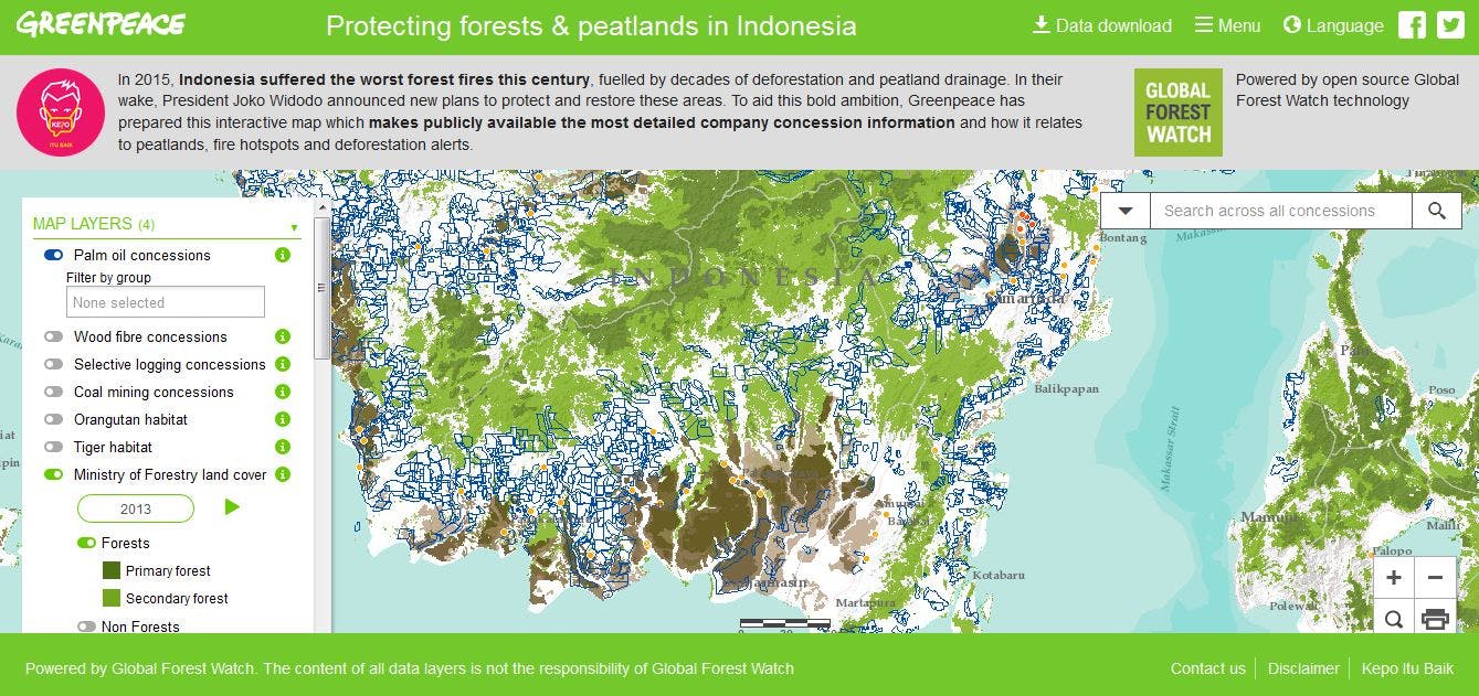
A screengrab from the Kepo Hutan web portal by Greenpeace. Image: Greenpeace
Greenpeace integrated its own map files with GFW’s open-source mapping software, as well as with GFW data on fire hotspots, forest cover, peatland depth, deforestation occurrences, and animal habitats.
The GFW tool also uses deforestation alerts issued by the Global Land Analysis and Discovery (GLAD) system developed by the University of Maryland and Google, which can identify deforestation in areas as small as two basketball courts - a much higher resolution than previous systems.
“We have done our best to gather in one place every map available,” said Surya.
“But public information on who controls our forests could and should be even better”, he noted, calling on the government to comply with formal requests to publish accurate and official concession maps. While the Greenpeace tool reveals company concessions, it does not include data on government-owned land.
Failure to make this information available to Greenpeace and the public could result in an official complaint in the country’s Public Information Commission, he warned.
Bambang Widjojanto, former deputy chief of Indonesia’s Corruption Eradication Commission, said at the launch of Kepo Hutan held in Jakarta that forest management efforts by the Indonesian government “remains far from fully transparent.”
“The public has the right to comprehensive geospatial information,” he said. “No-one should have to jump through legal hoops and wait months or years to gain access to scraps of vital data.”
“The government standard should be: all of the data, all of the time, available to all,” he added.


