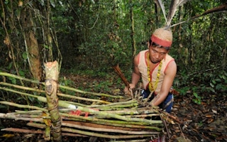
An organization representing Indonesia’s indigenous people is determined to map out the country’s customary forests in order to save them from the encroachment of palm oil companies and other development projects.
A recent ruling by the Constitutional Court which acknowledged that indigenous communities — and not the state — have rights over some 40 million hectares of customary forests influenced the decision to chart such lands, the Indigenous Peoples Alliance of the Archipelago (AMAN) said in a statement on Friday.
“We have already mapped seven million hectares of land, but that took us 15 years. We need to take advantage of new mapping tools like GPS and 3D mapping to accelerate the process of charting the more than 30 million hectares we have left to document,” Abdon Nababan, the secretary general of the alliance that represents some 17 million indigenous peoples, said.
Abdon told the Global Conference on Participatory Mapping of Indigenous Territories, which was held in Samosir, North Sumatra, over the weekend, that AMAN is aiming to map out all contested forests by 2020.
Nababan added that the need to map these lands has become more urgent since the Constitutional Court’s decision in May, which determined that a line in the country’s 1999 Forestry Law — which stated that customary forests are state forests — was not constitutional.
To take advantage of the landmark decision, Nababan said it’s crucial for indigenous peoples to put these forests on paper.
“Based on mapping technologies we have used so far and the lack of government support for our mapping efforts, it would take us 30 years to map all indigenous territories,” he said.
“But we don’t have that luxury. We need to learn [about mapping technology] from other indigenous peoples in Asia, Latin America and Africa about how to map more quickly and effectively,” Abdon added.
Kasmita Widodo, the national coordinator of the Participatory Mapping Network (JPKK), an organization that supports indigenous peoples’ mapping efforts, said the government has never mapped customary forests, which often overlap with concessions the government has handed out to palm oil and pulp and paper companies.
“Some 70 percent of forest areas in Indonesia are located in areas with overlapping permits,” he said.
Under its one-map policy, the government hopes to create a single map of all forests in order to clarify overlaps.
“It will be a challenge for the entire country… [but it is necessary] to facilitate a fair decision making process for indigenous peoples and to reduce conflicts,” Widodo said.
At the Global Conference, representatives of indigenous communities from across the globe who have mapped their lands using advanced technology gathered to discuss how to ramp up efforts to protect their forests and lands against development, climate change and other threats.
Indigenous peoples from Nepal, the Philippines, Brazil, Peru, Nicaragua and Kenya attended the event to share their maps and experiences.
The conference was organized by AMAN and the Phillipines-based the Indigenous Peoples’ International Center for Policy Research and Education.