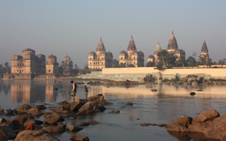
In October this year, the Indian forest department gave final clearance for a project to transfer water from the Ken river as it flows through the state of Madhya Pradesh to the nearby Betwa river.
The Ken-Betwa river interlink, which would involve damming the Ken and laying a canal to the Betwa, is supposed to be the first of 30 proposed river interlinks which would fundamentally transform India’s river systems.
The original idea was conceptualised in the 19th century by Arthur Cotton, a British general and irrigation engineer. Cotton suggested connecting all of India’s major rivers to enable better irrigation and navigation, and to capitalise on what was seen as the paradoxical phenomenon of having floods in one part of the country while other areas faced drought.
Post independence, despite official enthusiasm for large infrastructure projects, including hydropower dams, this particular approach did not gain any significant traction. In 1980 the Ministry of Irrigation (now subsumed under the Ministry of Jal Shakti) prepared a National Perspective Plan (NPP) “for transferring water from water surplus basins to water-deficit basins”, but no further government action followed.
In 2002, however, APJ Abdul Kalam, who was the President of India at the time, made a speech mentioning the subject. Using the speech, Ranjit Lal, a senior lawyer to the Supreme Court, filed a public interest litigation in September 2002, and the court pronounced a judgement soon after asking for the project to be accelerated.
Decisions made based on secret data
In 2012, the Supreme Court came back to the subject and declared in its judgement that that “these projects are in the national interest, as is the unanimous view of all experts, most State Governments and particularly, the Central Government”. But environmental experts who were consulted on the project as members of an expert committee set up as part of the Supreme Court judgements have regularly raised concerns.
“
The project was based on detailed hydrological and simulation studies duly accounting [for] the upstream/downstream needs, environmental flows, etc, in the Ken basin.
Bhopal Singh, director general, National Water Development Agency
Himanshu Thakkar, coordinator of the South Asia Network on Dams, Rivers and People, a network of activists working in the water sector, was a member of the Ministry of Water Resources’ expert committee on river interlinking from 2009 to 2011.
He told The Third Pole that while most of the committee members were government appointees who agreed with the project, independent experts like him, water management pioneer Rajendra Singh and watershed conservationist Vijay Paranjape often dissented.
One of the major issues for Thakkar was the use of secret hydrological data. “When I asked for the data as a member of the expert committee, I was told that the Ken is part of the Ganges basin, an international basin, and [since] hydrology figures of international basins are a state secret, these cannot be made available [even to the committee members],” he said.
“The hydrology data pertaining to the Ken basin and the Betwa basin is neither in the public domain nor has it ever undergone any independent public scrutiny. In fact, the rainfall data of districts the Ken and the Betwa pass through, in the previous four years (2023, 2022, 2021, 2020), is not appreciably different. So why has the Ken basin been categorised as having surplus water?”
Bhopal Singh, director general of the National Water Development Agency (NWDA) which is entrusted with the river linking project, disputes this. He told The Third Pole: “the project was based on detailed hydrological and simulation studies duly accounting [for] the upstream/downstream needs, environmental flows, etc., in the Ken basin.”
“The hydrological studies were done by the National Institute of Hydrology (NIH), Roorkee, and examined and reviewed by the Central Water Commission,” Singh added. The NWDA website carries a detailed project report based on a NIH study conducted in 2003-04, but the study itself is not included. Singh told The Third Pole that “the entire modelling cannot be shared”.
New science may upturn old models
Another urgent issue is that science has moved a far pace from Cotton’s time, and the impact of interlinking rivers may be much more complicated than was appreciated in the 19th century.
Subimal Ghosh, institute chair professor at the Indian Institute of Technology Bombay’s Department of Civil Engineering and convener of the Interdisciplinary Program in Climate Studies, explained that atmospheric water has traditionally not been factored into consideration of water cycles.
A recent study which Ghosh co-authored found that adjacent river basins do not exist in isolation, and moving water from one to another may have additional impact due to atmospheric water.
The study builds on the fact that towards the end of the Indian summer monsoon, when the soil is saturated and evapotranspiration (the supply of moisture from the land to the atmosphere) is fairly high, recycled precipitation contributes to about 25 per cent of monsoon rainfall. If water from one basin were to be used to irrigate another basin, the combination of increased evapotranspiration and wind could reduce the late monsoonal rain by 12 per cent in some arid regions of the country, and increase rainfall up to 10 per cent in other parts.
“Now we know for certain that altering the terrestrial water cycle can impact atmospheric processes,” said Ghosh. He argued that there is “an urgent need to include rigorous model-guided evaluation of hydro-meteorological consequences” for projects like river interlinking.
In response, Singh of the NWDA said that they could not comment on a hypothetical study. “Considering the scale of meteorological and hydrological cycles in the country, these inter-basin water transfers to water-short areas are minor in nature … As far as the Ken-Betwa link is concerned, the majority of harnessed flood water shall be utilised in the Ken basin itself and some water shall be utilised to fulfil the water needs of other regions including recharge of existing tanks in the Bundelkhand region,” he added.
The illusion of water surplus
A deeper problem, according to Thakkar, may be that the river basins classified as having a water surplus are only regarded as such because they are less developed.
He pointed out that districts in the upper Ken basin are largely devoid of water-intensive agriculture, and with few dams built for storage. In contrast, the lower Betwa runs through agricultural districts where water-intensive crops are grown, with a fair number of dams. The surplus, he said, is only an illusion created by the different levels of water utilisation in different geographies.
“Now dams are sought to be built in the upper Betwa region, which will create a shortfall in the existing lower Betwa basin dams,” said Thakkar. “That shortfall is proposed to be rectified by water from the Ken basin.”
In response, Singh said that the Ken-Betwa link is not only about the inter-basin transfer of water – the central premise of river interlinking from Cotton’s time to the Supreme Court decisions – but also about conserving flood water.
Most rainfall occurs in a few days during the monsoon, and “there are hardly any flows in the Ken during the non-monsoon period,” said Singh. “The region is also not very rich in groundwater due to hard rock and marginal alluvium terrain. We expect this project to stabilise the availability of water and improve water management in the region particularly during drought years.”
Major downstream impacts of river interlinking
Singh’s vision of the total utilisation of water raises its own issues, according to Depinder Kapur, director of the water programme at the Centre for Science and Environment in Delhi. “The more river waters we use for agriculture and irrigation and urban consumption, the less will be left to enter the sea, especially in peninsular India where rivers aren’t fed by Himalayan waters,” said Kapur.
According to a 2018 study, if all 30 proposed river interlinking projects in the country are fully implemented, the average annual discharge by the affected basins will reduce by 73 per cent. While the study focused on impacts to wetlands and estuaries, which would be deprived of key sources of water, there would also be major ramifications for the ocean.
A significant fall in the flow of fresh river water into the sea would disrupt the upper layer of water in the Bay of Bengal, which is made up of low-salinity and low-density water that helps maintain a sea surface temperature higher than 28 degrees Celsius.
This high surface temperature in turn creates low-pressure areas and intensifies monsoon activity, explained Mihir Shah, distinguished professor at Shiv Nadar University and former chair of a new National Water Policy drafting committee set up by the Ministry of Jal Shakti in 2019.
“Rainfall over much of the [Indian] subcontinent is effectively controlled by this layer of low-salinity water. A disruption in this layer because of the massive damming proposed by the river interlinks … could have serious long-term consequences for climate and rainfall in the subcontinent, endangering the livelihoods of a vast population.”
Rivers carry more than water, and sediment would also be held back by new dams built for river interlinking. This is a critical concern for the deltas of the Ganga–Brahmaputra, Mahanadi, Godavari, Krishna and Kaveri basins, home to more than 160 million people who would be deeply impacted by sea level rise due to climate change.
A new study of the Ganga-Brahmaputra Delta found that the approximately 1 billion tonnes of sediment that rivers currently carry each year would increase by 34-60 per cent in the 21st century because of more monsoon rainfall. More sediment in the delta would help to offset sea level rise and naturally sustain the delta.
But, as the 2018 study pointed out, if all dams involved in the proposed river interlinking projects are built, this sediment load would fall by 87 per cent.
Singh of the NWDA responded by saying that sediment trapping by reservoirs and their impact on deltas was “always exaggerated without proper scientific study”. While suggesting that such impacts would be “nominal”, he told The Third Pole that the NWDA had “already initiated system studies of the proposed link projects to study the likely impact of climate change on hydrology and water availability, demand patterns, surface and ground water interactions”.
Looking ahead, with the Bharatiya Janata Party having returned to power in Madhya Pradesh in the November 2023 elections, and with river interlinking having been featured in the party’s 2019 general election manifesto, it seems likely that work on the Ken-Betwa link will be prioritised as evidence of the plan making progress.
This story was published with permission from The Third Pole.


