Mr Sanjeev Sanyal, president of the Sustainable Planet Institute and Global Strategist at Deutsche Bank, presented his ideas on using walking as a design paradigm for cities.
Following his talk was a moderated panel discussion with Mr Andrew Fassam, senior director, Conservation and Urban Design Group at Singapore’s Urban Redevelopment Authority (URA); Mr Steven Goh, executive director of Orchard Road Business Association; and Mrs Ong-Koh Wee Nah, director for the architecture & commuter infrastructure development at Singapore’s Land Transport Authority (LTA). The discussion was moderated by Prof. Paul Barter of the Lee Kuan Yew School of Public Policy, National University of Singapore.
Planning a new city
Mr Sanyal began by outlining three broad areas any urban planner would have to address when planning a new city: environment sustainability, economic viability and social sustainability.
These to him are perennial considerations in planning, but what is distinct today is the “multiplicity of life in the 21st century”, whereby the “regular cycles of 20th century life” have broken down. For instance, a typical work day no longer exists in the 21st century; where one would leave home in the morning, commute to work, spend a certain number of hours working before returning home and pursing one’s own leisure, etc. In addition to this is the “multiplicity” of the social unit, where nuclear families are less mainstream, single households are becoming more common and multi-generational households are making a comeback.
Therefore, today’s urban landscape is defined by multiplicity and within that, the use of different modes of transportation by all kinds of people.
Why “Walkability”?
Mr Sanyal defines planning “walkability” as allowing an average citizen to use walking as an important, if not dominant mode of transport for work and leisure. This is more than creating nice sidewalks; it includes air quality, shade, parks, public toilets, lighting, security and safety, accessibility for the disabled and the aged, etc. It also means connecting through to other modes of transportation. He explained that every form of public transport is ultimately based on walking because the last and first mile has to be walked. Therefore, designing for public transport, at some level, is essentially about designing for walking.
Why “walkability”? It is cheap, it is low technology and it combines flexibly with other modes. It is scalable in that it can be introduced in big cities as well as small ones. It also simultaneously resolves issues of environmental, economic and social sustainability. Walking is an important ingredient in creating “urban buzz” that generates much economic value, making successful cities what they are today. Mr Sanyal suggests that the street cafes of Paris, New York’s Central Park and the pubs of London have generated more ideas than the libraries and labs in the world.
In terms of social inclusion, he raised the example of Mumbai. While the city may have witnessed ethnic and religious skirmishes, not once has there been class conflicts, and he attributes this to the train system that is used by all members of society, which allow the rich and poor to interact at close proximity. While no one is suggesting allowing only walking in a city, it can become a backbone system that allows people to mix and match transportation.
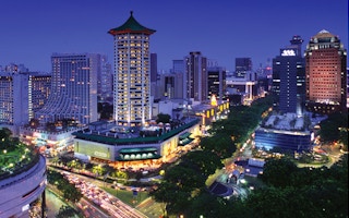
Mr Sanyal also presented examples of fairly new but “unwalkable” cities, such as the area surrounding the highway in Gurgaon and certain parts of New Delhi. In comparison, he raised the examples of central Seoul and the High Line in New York City as ingenious planning that have increased walkability. For Singapore, walkability has also improved over the years as well as for cycling due to the many new park connectors around the island.
Global Walkability Index
Mr Sanyal introduced his Global Walkability Index project, which uses a number of criteria to determine walkability across different cities. These include pedestrian infrastructure, such as pavements, over-bridges, streetlights and signage; connectivity to other forms of transport; urban form, which is the ecosystem of shops, offices, the mixed use of cafes and street life; distance; air quality; safety; crime; policing; legal system; emergency services, and so on. He clarified that these are his own subjective views of how cities work and the index only includes cities that he has extensively walked through in the last five years.
“
Why “walkability”? It is cheap, it is low technology and it combines flexibly with other modes. It is scalable in that it can be introduced in big cities as well as small ones. It also simultaneously resolves issues of environmental, economic and social sustainability.
Sanjeev Sanyal, Deutsche Bank’s global strategist and Sustainable Planet Institute founder
Mr Sanyal pointed out that weather plays no role in his criteria. This is because, from his interactions, people always assume that their city is unwalkable because of weather conditions and the climate.
In the Index, the most walkable city is Zurich, followed by Singapore. The worst city is Johannesburg, which not only has bad infrastructure but is very unsafe. However, it is not always the poor cities that do badly. Phoenix, a relatively prosperous American city in Arizona, has an urban form that is effectively unwalkable.
One category where Singapore does not score above 9 is connectivity. This is partly due to the taxi system, which breaks down whenever it rains. To illustrate the issue of connectivity, Mr Sanyal gave the example of pedestrian access from Orchard Road across Paterson Road, a major intersection in the city that was recently closed to pedestrians. Today, a combination of poor signage, complicated underground access and overabundance of distracting retail real estate often leaves one stranded when trying to get across the road. Even for the familiar pedestrian, crossing the underpass to get to the other side of the road can take more than four minutes. Mr Sanyal ended his presentation by questioning the rationale of enabling vehicular traffic at the expense of pedestrian traffic in this case.
Panel Discussions
Each panellist gave a brief presentation in relation to the topic of walkability before taking questions from the audience.
Mr Andrew Fassam explained that pedestrian-friendly urban design is a key component of URA’s planning. For URA, the city network is divided into three levels: the street level, underground links and elevated space.
The key focus remains on the street as a primary space for interaction and access. In fact, all developments in the key precincts today include covered walkways fronting the adjacent streets, and the width of these covered walkways is carefully planned and varies depending on the location and the anticipated traffic.
Within the city, underground rail coverage and the stations are generally planned to lie 600–800 metres centre-to-centre, which results in a very extensive network of underground pedestrian links within the key precincts. Once fully completed, Singapore’s underground pedestrian links will span almost 29 kilometres.
In terms of safety and attractiveness of the city and the pedestrian network, URA designs underground pedestrian links by examining their width and floor-to-ceiling heights, to ensure that they are quite spacious and attractive. The government also actively encourages the development of these underground networks through cash grant incentives to businesses.
In terms of the elevated space, within the CBD, URA has planned for an elevated linkway that connects through the CBD and into the new development area at Marina Bay. This comprises a series of second-storey links located within the developments, and from these links one will be able to access office lobbies and food courts within the developments. This will make it easy for people to move around in all-weather comfort within the area. The URA also develops through-block links and view corridors, such as the plaza at OUB or the Change Alley link, linking through to Collyer Quay, which provides a sense of orientation and links various different spaces.
Finally, in terms of cycling, Mr Fassam explained that agencies like National Parks, LTA and URA are now actively looking at a more comprehensive cycling network with supporting facilities such as bike parking, etc. These agencies are also looking at bike sharing, bike rental as well as parking facilities to enable cycling.
Next, Mrs Ong-Koh Wee Nah responded to Mr Sanyal’s example of the Paterson Road crossing as a poor example in walkability. While it may seem like LTA was giving in to car owners at the expense of pedestrian convenience, she highlighted that the heavy traffic in the area, caused by high pedestrian traffic at the crossing, had in fact badly affected public transport such as buses. Thus, when Ion Orchard was developed, planners took the opportunity to divert pedestrians underground. Even though the walking distance became longer, the underground route is not unpleasant and it has significantly improved vehicular traffic on the road, which is to the benefit of all commuters, not just car owners. This case also illustrates some of the challenges LTA faces in terms of balancing the interests of different road users.
Mr Steven Goh shared an image of Orchard Road from about 100 years ago and compared this to the present-day shopping belt. For him the negotiation between motorists, pedestrians and the retailers for space is consistent throughout the different periods. Members of the Orchard Road Business Association often feel that Orchard Road is designed for motorists, judging from the amount of space given to cars and car parks.
“
The city was unfortunately not planned for cycling because at the time when the economy boomed, motor vehicles were one of the key drivers for this economic development. Today, planners are trying to create a balance between what is more convenient and what is more sustainable.
Ong-Koh Wee Nah, Land Transport Authority director for architecture & commuter infrastructure development
However, if Orchard Road were built for pedestrians and made more walkable, this would actually bring more business to the retailers. With regard to the closing of the Paterson crossing, for instance, the Association is now trying to negotiate with government agencies to see if they could reopen the crossing during weekends. Considering that the whole stretch of Orchard Road is 2.2 kilometres, this crossing serves a very important purpose in the connectivity of the area. Mr Goh recognised that there was indeed traffic pile-up, but he agreed with Mr Sanyal that passengers and drivers who sit in air-conditioned vehicles would find this less stressful than people who have to navigate the maze of the underpass, especially tourists who are often lost in the area.
Prof. Paul Barter of the Lee Kuan Yew School of Public Policy then invited the audience to pose questions to the panel. In summary, the discussion ranged from weighing the commercial interests of business owners, such as those along Orchard road, against the convenience of pedestrians; using landscaping to create public spaces for greater interaction between people and the environment; giving up cars to embrace walking as a culture in Singapore; addressing issues such as security and safety as well as promoting the health benefits of walking. The following are some key highlights from this discussion.
Highlights from Q&As
Q: Around 80 per cent of Singaporeans live in the heartlands and walking there is a difficult thing; you often have to walk 400 metres to get across the road and back. What is the approach of the LTA in improving walking in the heartlands?
Mrs Ong-Koh outlined LTA’s plan of providing 200-kilometres of covered linkways in Singapore’s heartlands within five years, to enable greater pedestrian traffic. This is a significant distance when compared to the circumference of Singapore island, which is about 193 kilometres. By making walking more pleasant, LTA planners want to create the first and the last mile to transport nodes so that people are encouraged to walk. As for cycling, the city was unfortunately not planned for cycling because at the time when the economy boomed, motor vehicles were one of the key drivers for this economic development. Today, planners are trying to create a balance between what is more convenient and what is more sustainable. LTA is experimenting with cycling paths in seven towns, but because these towns were planned much earlier, the only space for cycling would be to use pedestrian footpaths and sometimes take away green spaces. In future precincts, LTA is looking into increasing the roads reserved for cyclists and hopefully create more space for them. Meanwhile, pedestrians, drivers and cyclists need be more tolerant of one another, to share the limited space.
Q: In Singapore, “line of sight” travel is limited even in the waterfront area of Marina Bay, because everything has gone underground. Does this not in fact diminish ground pedestrian travel, which is where all the action happens? Also, people want to be outside and to interact with nature; they do not want to be in air-conditioned environments at all times. Singapore is perhaps scored too highly in this respect?
Mr Fassam explained that Singapore actively benchmarks itself against many other cities and it invariably gets compared to Hong Kong. Hong Kong has a much higher density and an extensive second storey network, but Singapore does not want to go the route of Hong Kong because planners want the street to remain active.
A lot of the planning of the city in the past has focused on vehicular traffic — making sure the traffic moves smoothly, etc. URA is now trying to pull that back and balance it with making a lot more pedestrian-friendly and oriented precincts. The primary focus is in making streets walkable, and the main difficulties are in balancing that with the vehicular traffic. Therefore, when developing the underground network, it is really a supplementary network.
The city has been fortunate in that all the stations in the city have been built underground, which then allows URA to extend linkways from the stations under the roads to the adjacent developments. This gives commuters convenient access from the station to the surrounding developments within a 400-metre radius.
In addition, URA has called a tender recently to appoint a consultant to help agencies work on a new plan for the civic district, which will also extend to the One Fullerton area and Fullerton Hotel. It is looking actively at improving connectivity between the various developments, and preliminary discussions with LTA indicate that it can look at reducing some of the road carriageways around St Andrew’s Road and the Padang, and make the whole area more walkable.
One of the recent successes is the temporary road closure along Club Street and Ann Siang Road. While URA cannot close roads because of access, what it can do is to have a more flexible and fettered approach — if access is not required in the evenings or over the weekends, it can close the road and at least make it more pedestrian-friendly environment at these times. The same scheme will be implemented at Haji Lane so hopefully this will help reclaim a bit more of the city for pedestrians and also for cyclists as well.


