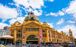
With housing affordability issues forcing more working and low income households to the outskirts of our cities, governments need to shift the focus on transport oriented planning to the outer suburbs, according to a new policy paper released by the Bus Industry Confederation.
Connecting Neighbourhoods: The 20 Minute City was jointly authored by adjunct professor John Stanley from the Institute of Transport and Logistics Studies at the University of Sydney Business School, Dr Janet Stanley social policy adviser for Stanley & Co, and Stephen Davis, industry development and planning manager for BusVic.
The 20-minute city concept is defined as an area with a radius of about five kilometres – about a 20-minute public transport or cycle trip – with a potential population catchment of about 200,000-plus people. It therefore covers an area incorporating a number of communities and neighbourhoods that between them offer most of the services, activities and social infrastructure to meet essential needs.
This includes both practical needs such as shopping, medical care, education and community spaces, as well as intangible needs relating to wellbeing such as a sense of place, a sense of belonging, and opportunities for participation. These areas also need to provide some opportunity for local employment.
In addition to providing a range of local activities, the authors say the area requires local mobility choices, “particularly safe walking/cycling opportunities and an adequate service level on public transport.”
“These can best be provided where urban densities are planned for this purpose.”
How Melbourne’s grand plan is falling short
The 20-minute city concept has been mentioned in Plan Melbourne, but the authors say the idea was “little developed” in the plan. The concept is not being put into practice, they say, because there is insufficient integration of transport planning and development planning.
“
The 20-minute city concept is defined as an area with a radius of about five kilometres – about a 20-minute public transport or cycle trip – with a potential population catchment of about 200,000-plus people.
This is particularly the case in the outer suburbs of major capital cities, where development is occurring on multiple greenfield sites simultaneously, many of which are not achieving sufficient density in the early stages to make conventional public transport viable. This means that when people move into these areas they are entirely car-dependent due to the lag in local infrastructure provision.
For this reason, the authors say development needs to be planned and managed in outer areas to achieve sufficient density in manner that coincides with public transport infrastructure provision. Further, these areas need to include a mix of educational, medical, social, recreational and retail facilities from early development stages that create the local neighbourhood and enable localised activities.
This would also help create a degree of local employment in areas that statistically show extremely limited local employment prospects compared to inner city or middle-ring suburbs.
“Supportive densities are fundamental to achievement of a city as a series of 20 minute cities. But this is not enough. Densities need to be complemented by high quality local mobility opportunities that are available to all, implying the availability of high quality public and active transport (walk and cycle) choices. Public transport performs mass transit and local transit roles. Mass transit is mainly about getting in and out of your neighbourhood and/or 20 minute city; local transit is mainly about getting around your neighbourhood/20 minute city,” the authors say.
Warrnambool’s breakthrough solution
A cost-benefit analysis that factors in a dollar value on the wider social benefits of public transport shows that for a bus service in any area to be economically viable, around five or six passengers must be getting on the bus every hour. Where there are still very low densities of potential public transport users, the authors suggest an innovative social enterprise model that can be used as either a bridging or supplementary transport solution.
The ConnectU service that has been trialled in Warrnambool in regional Victoria provides public transport for people who live where there is no service, or who due to special needs cannot utilise existing services.
It makes use of currently underutilised transport assets such as community buses and cars owned by service providers, local government and agencies with the services of volunteer drivers.
“The ConnectU model is cost-effective and should be tested for extension to service provision in low volume outer urban settings, as a complement to, not replacement for, the route bus service. The ultimate operating goal should be ‘total transport’, with service integration across a full range of opportunities. This goal is in line with new approaches recently proposed by the UK House of Commons Transport Committee,” the authors say.
How policy can get with the program
The policy recommends a number of changes to planning policies, including the creation of an alternative set of development standards and processes for transit-supportive development.
Suggestions include density/height bonusing opportunities and fast approval processes. It also suggests that boundaries for medium to high density nodes should be based around at least 90 per cent of people being within a 5-10-minute walk – between 400-800m – of a public transport focal point, with the distance varying depending on the frequency of services, and that similar distances should also define the boundaries of medium to high density public transport corridors.
Planning should also provide for good quality walking and cycling routes within any development area as part of the general infrastructure provision.
Walkability pricing people out of inner suburbs
One of the issues the authors identified with current trends in terms of walkability and Transit Oriented Development in inner and middle-ring suburbs is that it is generally working against housing affordability.
“TOD type initiatives have generally not been very successful at increasing the supply of affordable housing, being frequently positioned at relatively high price points,” they state.
Walkability is observably raising both rents and sale prices for homes, for example, in 2013 buyer’s advocate firm Secret Agent said prices can rise as much as $298 a square metre in Melbourne for a five-point rise on an area’s “Walk Score”.
The authors said that housing affordability needs to be part of the planning policy, noting that initiatives such as lowering requirements for onsite parking can benefit affordability and increase the uptake of public transport.
How transport policy can deliver land use visions
The policy stresses that transport planning needs to be used to deliver land-use goals, and that simply focusing on major roads is not even close to a solution.
“Urban transport and land use planning have traditionally been treated as ‘top-down’ activities, which start by identifying some loosely defined high level economic, social and environmental outcome goals for the greater urban area. The dominance of major transport infrastructure in city shaping, however, is such that it is crucial for the land use/transport planning process to first decide on a clear vision of desired future land use and then use transport to help deliver that result,” it says.
“All too frequently in Australian capital cities ‘big transport projects’ have taken on political lives of their own and urban land use/transport integration becomes lost in the mire, as these projects are imposed on land use. An incapacity to establish, and then stick with, bipartisan integrated long term land use/transport strategies is one outcome. Governance arrangements must tackle this problem in Australian cities.”
In the suggested governance and funding arrangements, the policy suggests two key programs and one investment fund to drive the key outcomes for a 20 minute city: Unlocking Our Roads: a National program to reduce Congestion, The Stronger Neighbourhoods Program, and the National Public and Active Transport Infrastructure Fund.
The National Public and Active Transport Fund could be used to provide funding to State and Local Government public transport systems in areas of identified need; deliver start-up capital and investment into public transport projects designed by State and Local Governments; and provide funding for identified areas of need to increase service frequency and reliability and reduce travel costs.
The “Five Ds” that determine vehicle use
The authors outline the “Five Ds” of the built form and how they impact on car travel distances by residents.
- Density – higher densities support more local activity opportunities, higher public transport service levels and walking opportunities. Destination density is particularly important.
- Diversity of land uses makes it easier to undertake activities locally, associated with ideas such as mixed-use development and jobs/housing balance.
- Design – particularly creating interesting places where people want to be, are safe and feel safe.
- Destination accessibility – ease of access to trip destinations and developing activity nodes and corridors.
- Distance to transit – supported by fine-grained pedestrian opportunities, embedded in intersection density and street connectivity.
- Downloaded the full policy.


